We spent the night just west of Houston, but still had a few highways to navigate.
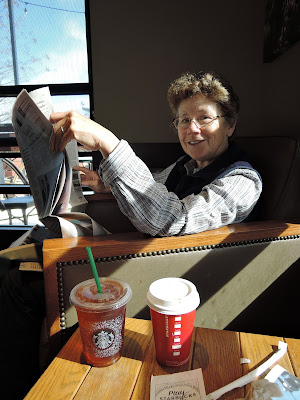
By noon the traffic was thinning out. We pulled into a Starbucks to catch up on news and relax. Great to read a New York Times after a diet of CNN soundbites.
Snowmen and Christmas trees are a tradition even in 70°F Texas, but tents are needed to protect the cut trees from the sun.
By 2 PM we'd reached the LBJ Ranch in Stonewall TX.
The site is run by both the National Park Service and Texas Parks.There is a lot of Johnson memorabilia.
The Johnson presidency is remembered by many for the deepening involvement of the US in the Vietnam War. It is also saw the passage of a lot of excellent social legislation, including the Elementary and Secondary Education Act commemorated in this display. This act marked the first time the federal government committed to helping local schools and education. (There was also the 1964 Civil Rights Act, 1965 Voting Rights Act, 1966 Child Nutrition, 1967 Age Discrimination --- Check here for a good summary.]
This is the jet Johnson used to get to the Texas Whitehouse
We had a tour of the house, but were not permitted to take photos. The reason for no photos is that the Park Service does not want flash photography and most people don't know how to turn off the flash on their camera.
Dam on the Pedernales River. LBJ enjoyed shocking visitors by driving them across this dam.
We got to Fredericksburg TX at about 5.30PM. First stop was at Walmart so Midge could get a haircut and to buy food to take to Big Bend NP.
We booked the Peach Tree Inn & Suites on booking.com. It was less than $30 with tax, less than a typical state park campsite. It turned out to be a large apartment with cooking facilities.It was now late so we decided to go into Fredericksburg for dinner. East Main Street was decked out for Christmas.
It was warm enough to sit outside
with a heat lamp, a jacket and a hot band.
We had dinner at Der Lindenbaum. Midge had weinerschnitzel and Ed had sauerbraten. Fredericksburg was founded by Germans in 1846.
Day 40 10 December 2015 Fredericksburg to Seminole Canyon State Park TX (235 miles)
Before we left Fredericksburg, we walked to the top of Cross Mountain (elev. 1951 feet). View of Fredericksburg from Cross Mountain.
Prickly pear cactus on Cross Mountain.
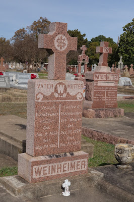
From Cross Mountain we drove back through Fredericksburg. This is the Catholic Cemetery near the Post Office.
The Market Square in Fredericksburg featured a traditional German angel chimes or angel-abra
and a huge Christmas tree.
When we checked in to the Peach Tree Inn last night we talked to our host at the front desk. He has done a lot of hiking and travelling in west Texas, and was happy to give us tourist advice. He recommended Seminole Canyon State Park as a both a place to camp and for its historic rock art. He was also adamant that we avoid Interstate 10 and instead take a more southerly route through the rolling hill country.
From Fredericksburg we took Route 16 through Kerrville to Medina. The "Ranch Road" between Kerrville to Medina was slow, twisty and scenic. At Medina, we took the even less travelled Route 337 to Camp Wood.

Every gulley had a sign to help you judge water depth in case of flooding.
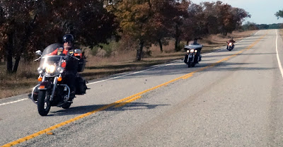
The route attracts many touring motorcyclists.
At Brackettville we got on Route 90, which took us the remaining 72 miles to Seminole Canyon State Park. Route 90 had trucks, passing lanes and a 75 mph (120 kph) speed limit.
Del Rio TX is next to the border with Mexico. Just north of it is the Amistad Reservoir on the Rio Grande. This reservoir is in both Mexico and USA.
At 4.15 we got to Seminole CanyonOur campsite at Seminole Canyon State Park and Historic Site
Day 41 11 December 2015 to Big Bend N P (223 miles)
The sun wasn't quite up at 7am.
Ed fixing breakfast at our campsite.
The park has petroglyphs and some of the oldest rock art in the US. We could have gone with a park ranger on a tour of the rock art, but we;d have had a late start on the drive to Big Bend. Luckily, the visitor center had excellent reproductions of the art.

At Langtry we stopped at the visitor center. Like all Texas visitor centers we saw, there were helpful staff and interesting displays. In this case, the center included Judge Roy Bean's saloon and court house.
The visitor center also had a garden of desert plants.
The US Border Patrol has check points inside the US on roads leading away from the US-Mexico border. Here we were heading toward the border so we did not have to stop. At first we thought we might need passports or other ID, but when we did have to stop, we were only asked if we were both US citizens. When we answered "Yes," they waved us through.
Lunch stop on Route 385, still north of the park.
Park entrance
Approaching River Road East on the way to Rio Grande Village.
Tunnel at Dead Man's Curve on final descent to Rio Grande Village. The mountains in the background are the Sierra del Carmens, across the Rio Grande in Mexico.
Ocotillo (Fouquieria splendens) - the green leaves have turned a beautiful autumn yellow
The Rio Grande Village Campground had food safes to keep bears and javalinas out of the food, and to minimise the risk that they become scavengers in the campground.
After dinner we walked behind the campground to a hill overlooking the Rio Grande. Everything to the left (south) of the river is Mexico.
From the hill we could see Boquillas del Carmen, Mexico.
Changing light on the Sierra Del Carmens as the sun set.
.oOo.


No comments:
Post a Comment